
 |
| Andy Farrant |
Think about Arabia, and normally an image of deserts, endless sand dunes and camels comes to mind, not verdant green pasture, rivers, lakes and herds of grazing animals. Yet at various periods during the last few hundred thousand years, this is exactly what Arabia has looked like. Changes in global climate have periodically transformed Arabia from an arid desert into a more welcoming savannah landscape, replete with wildlife. Understanding when these wet periods occurred is critical for understanding human evolution. This is because Arabia lay at a bottleneck for early humans migrating out of Africa into Asia. Too dry and early humans would have faced an impenetrable desert barrier. This has sparked a considerable amount of scientific debate as to how early humans crossed out of Africa into Eurasia.
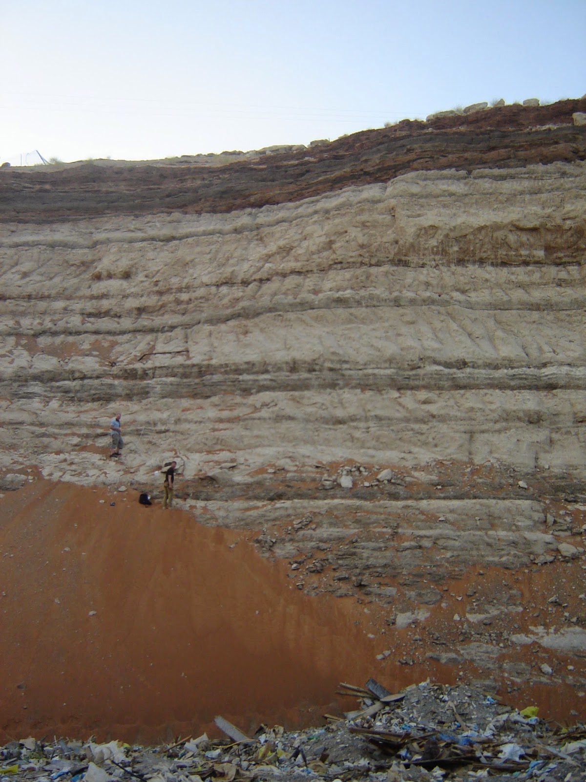 |
| The Al Sibetah quarry near Al Ain, a 42 m section in stratified alluvial fan sediments spanning160,000 years. Professor Adrian Parker and Dr Ash Parton (upper figure) for scale. Photo (c) A R Farrant. |
Research just published by the British Geological Survey and Oxford Brookes University (Parton et al., 2015; Geology) has suggested that the latter scenario is most likely. By analysing river sediments near Al Ain in the United Arab Emirates, we unearthed a unique and sensitive record of landscape change in southeast Arabia spanning the past 160,000 years which provides evidence for several wet climatic interludes during both glacial and interglacial periods. These periodic wet phases allowed humans to migrate across the interior of Arabia several times during the past 160,000 years.
So how did we come to work on the climate of Arabia? The story began in 2002, when BGS was contracted by the UAE Ministry of Energy to undertake a comprehensive geological mapping project, covering the whole country. This included mapping the extensive alluvial fans emanating out from the Hajar Mountains and the dune sands of the Rub al Khali desert, popularly known as the ‘Empty Quarter’. During the mapping work, it soon became apparent that these Quaternary sediments were far more interesting than most people realise. Our mapping identified numerous quarries between Dubai and Al Ain which exposed thick alluvial fan and dune sediments. As alluvial fan systems only form during wet climatic periods, whilst dune sands accumulate during arid phases, these interbedded fan and dune sands had the potential to record a detailed palaeoclimate record spanning the last few hundred thousand years.
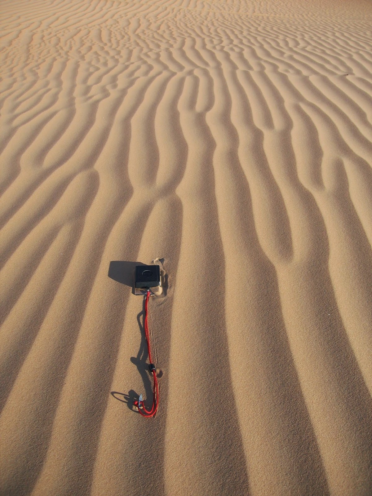
| Working in the 'empty quarter' |
So, in 2008, we were back mapping in the UAE. Logging the sections was not easy. Fieldwork in the UAE sounds glamorous, but the reality was working in a sun-scorched, smelly pit, strewn with rubbish and camel excrement with only flies for company and temperatures approaching 40°C. However, the hard work, dust and sweat paid off. Through painstaking sedimentological, geochemical and isotopic analyses, the latter with the help of Professor Melanie Leng of the NERC Isotope Geosciences Laboratory here at BGS, Ash constructed a detailed record of climatic and environmental change for this part of Arabia. Dating of the sediments was done by Dr Matt Telfer using a dating technique known as optically stimulated luminescence (OSL) dating.
 |
| Map
showing location and photo of the study site (Sibetah) and extent of relict alluvial fan system in SE Arabia. Jebel Faya and other study sites are shown. |
Our findings, published in the journal Geology have shown that wet climatic periods in Arabia were not driven by global ice volume changes during interglacial conditions every ~100,000 years. Instead the quarries at Al Ain demonstrate that the vast alluvial fans along the western Hajar and Oman Mountains became active approximately every 23,000 years since at least ~160,000 years ago. These wet periods were triggered by periodic northward shifts in the position and strength of the Indian Ocean Monsoon, driven by subtle changes in the Earth’s orbit every ~23,000 years. During these times the vast Arabian deserts were transformed into landscapes littered with freshwater lakes and active river systems, providing ample opportunities for humans to disperse across the region en route to the rest of Eurasia.
Moreover, this is but one of the academic spinoffs from the UAE geological mapping project. Dating of the desert sand across the UAE have clarified the timing of dune formation, stabilisation and links to past climate, whilst mineralogical analysis of the sand has yielded insights into the provenance and formation of the dune systems. BGS colleagues have also been busy studying the evolution of the UAE-Oman ophiolite complex, exquisitely exposed in the Hajar Mountains, and understanding salt dome evolution in the Arabian Gulf.
In short, geological mapping not only underpins the economic well-being of a country, but can also deliver some fantastic science.
Andy
 |
| Working in the 'empty quarter' |
Reference
A. Parton, A. R. Farrant, M. J. Leng, M. W. Telfer, H. S. Groucutt, M. D. Petraglia, A. G. Parker. Alluvial fan records from southeast Arabia reveal multiple windows for human dispersal. Geology, 2015; DOI: 10.1130/G36401.1
Acknowledgements
Thanks to all the members of the BGS UAE mapping team, in particular Richard Ellison and Mike Styles, and to the UAE Ministry of Energy for funding the mapping in the first place.
Dr Andrew Farrant is a Principal Geologist at the British Geological Survey and led the geological mapping element of the UAE project from 2006-2012. He mapped the area around Al Ain including the Al Sibetah quarry. He continues to research climate change in Arabia.
Dr Ash Parton did his PhD research in the UAE whilst at Oxford Brookes University, part funded by the British Geological Survey. He is currently a member of the Palaeodeserts Project at the University of Oxford, which is seeking to better understand the relationship between environmental change in Arabia and the demography of early human populations.
Comments